


Solar cadastre
Urban-scale solar surveysSolar cadastre
This model can be used to generate a solar cadastre, which can then be incorporated into the local authority’s geographic information system (GIS) and/or uploaded to its website.
Determining the solar energy potential: global contribution, potential contribution for façade doors, windows, etc.
Detecting « sunless » zones
Smart grid: calculation of the electricity use covered by the potential PV energy and improved performance through storage (buildings or hubs)
Technical aspects of the solar cadastre
Solar cadastre takes account of roof and wall orientation and pitch. Calculations are based on the algorithms in the ARCHELIOS® software.
Solar cadastre automatically factors in the shade caused by the terrain, known as the horizon line (hills, mountains, etc.), based on topographical data from NASA.
Solar cadastre also takes account of the near shading (other buildings) based on a 3D model.
Examples of solar cadastre
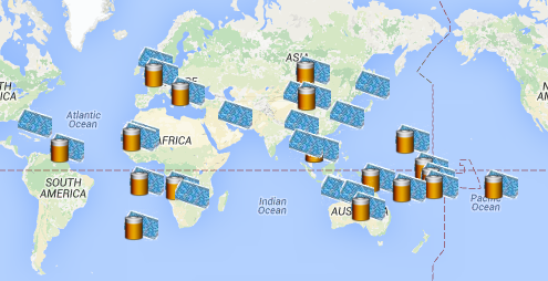
06. Global map of hybrid PV systems
Type of mission: Solar mapping Energy: Solar hybrid Customer: Confidential Country: World Description: Global map of hybrid PV systems (combined with generators), with or without storage
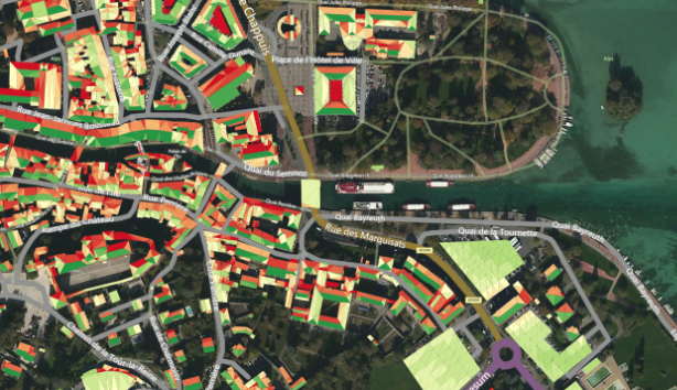
03. City-wide solar cadastral map + green roof cadastral map (in progress)
Link on the Geoportal Type of mission: Solar cadastre Energy: Solar Customer: City of Annecy Partners: Geomap-Imagis & LesENR Country: France Description: City-wide solar cadastre + green roof cadastral map
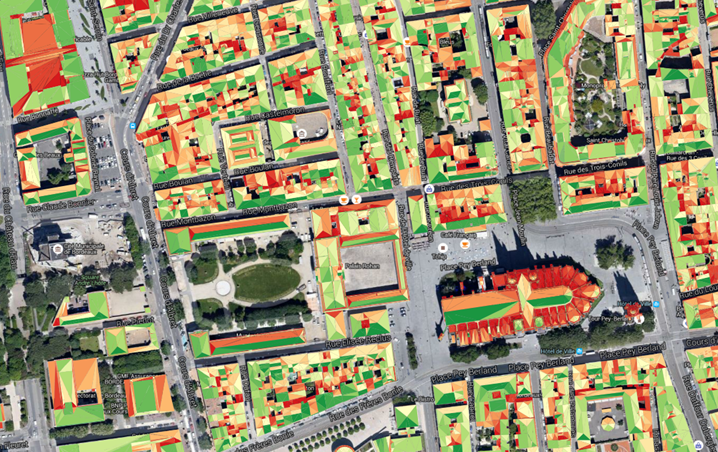
02. City-wide solar cadastral map (in progress)
Type of mission: Solar cadastre Energy: Solar Customer: City of Bordeaux Partners: Geomap-Imagis Country: France Description: City-wide solar cadastre (in progress)
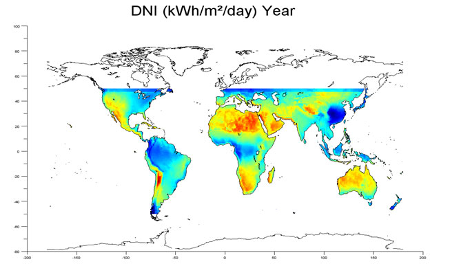
5. Global maps for comparing PV – CSP – CPV technologies
Type of mission: Solar mapping Energy: Solar Customer: INES-CEA Country: World Description: Global maps for comparing PV – CSP – CPV technologies
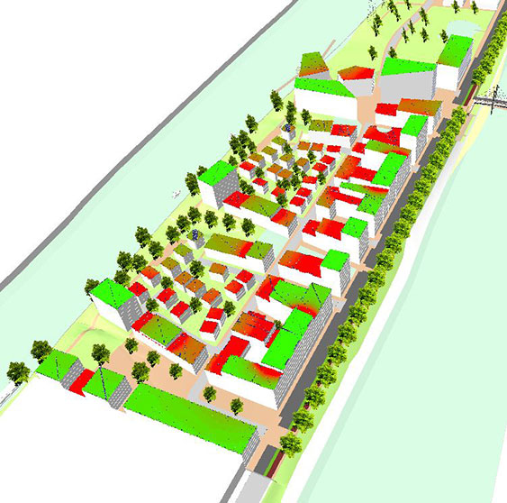
04. Ile St Denis eco-district
Type of mission: Solar cadastre Energy: Solar photovoltaic and thermal Customer: Plaine Commune municipal association Country: France Description: Solar Cadastre – Ile St Denis eco-district
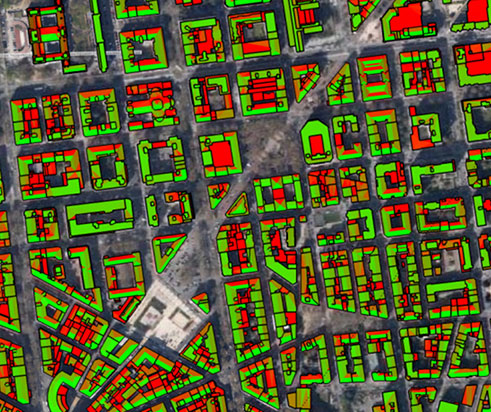
01. Mapping of the solar energy potential of 10,000 roofs
Type of mission: Solar cadastre Energy: Solar photovoltaic and thermal Customer: City of Lyon Country: France Description: Mapping of the solar energy potential of 10,000 roofs